The Weather Channel forecasts Leonida: six new GTA 6 screenshots about the weather
A real weather channel forecasting a made-up state. On the evening of November 16, at 8:40 pm UTC, The Weather Channel posted a bulletin for Leonida on X: six new GTA 6 screenshots, each with its own forecast written as if for the real Florida. “Rockstar gave us an exclusive look”, the channel says. Three days before launch, these are the first new official images since the November 5 gallery.
What Rockstar says
The thread opens with Shepherd’s words. Leonida, he explains, is inspired by Florida, “one of the most unpredictable weather systems in the US”, and to match the rest of the game Rockstar had to rebuild the weather from scratch. The result ranges “from clear blue skies to towering vertiginous cumulonimbus clouds”, in the hope that real Floridians will recognize it.
It’s not the first time Rockstar has talked about it. In September the Game Informer cover story confirmed tropical storms and hurricanes. The new screenshots are the first time the system is shown at work in six different places on the map.
The six forecasts, one by one
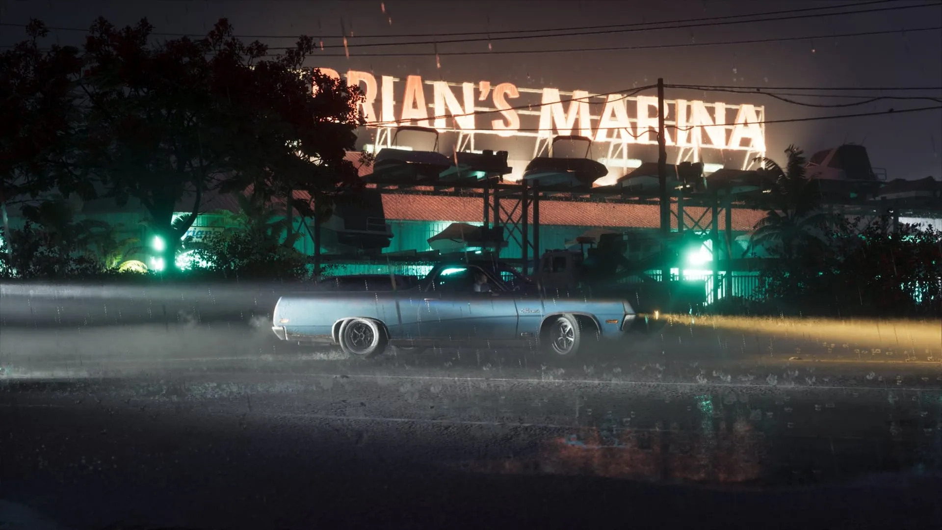
The Keys, at Brian’s Marina: the rain kicks up so much moisture that visibility drops, and the channel suggests getting your headlights fixed at Coastal Auto Care. The sign belongs to a boat storage yard, and in the Leonida Keys the best-known boatyard is Brian Heder’s: that it’s his is our own inference. © Rockstar Games, via The Weather Channel.
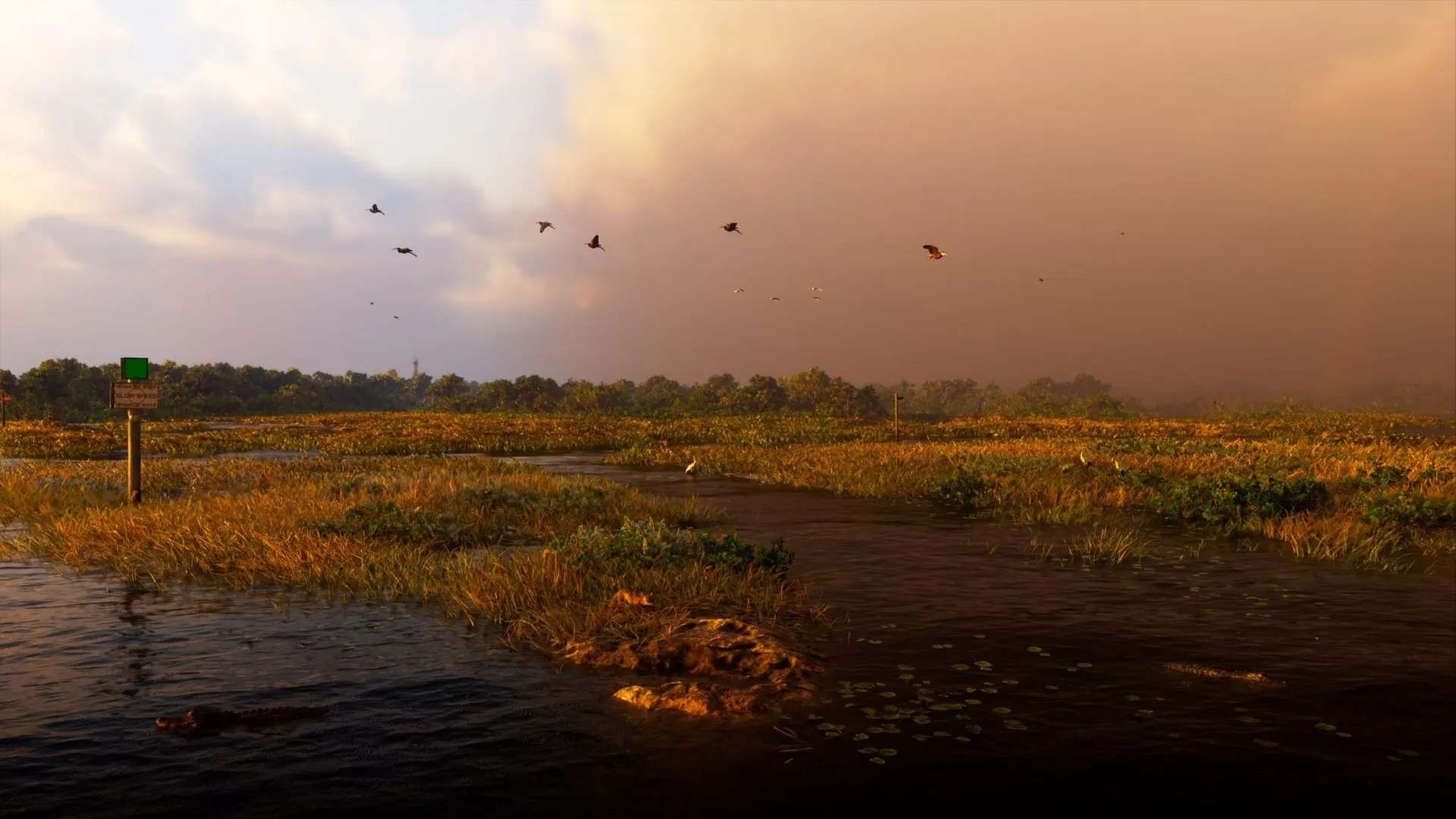
Pelican Valley: the storm makes the swamp water even murkier, so it’s “nearly impossible to spot the big nibblers”. Bottom left, an alligator swims at the surface; on the bank, a small animal looks toward the water. © Rockstar Games, via The Weather Channel.
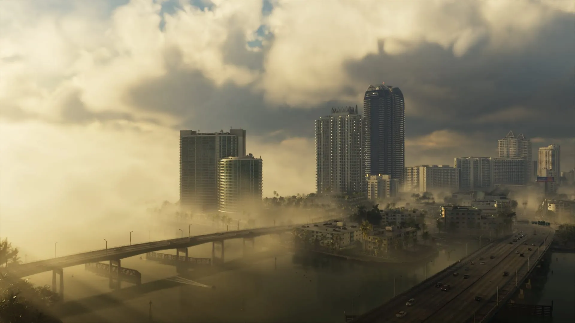
South Ocean Beach: a wall of sea fog rolls in off the ocean and hides the view from hotel guests. The name points to Ocean Beach, the seaside district of Vice City. © Rockstar Games, via The Weather Channel.
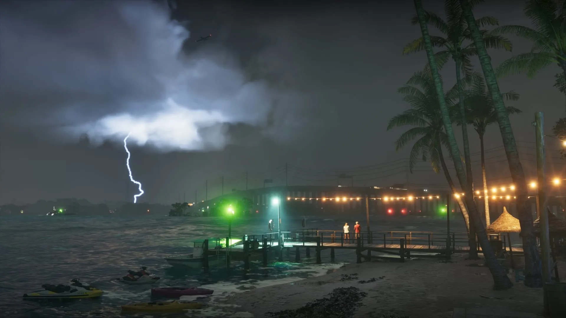
The Rusty Anchor: a tropical storm whips up the sea, and the channel jokes that you “might need a bigger boat” to go drinking there. It’s the most striking of the six: lightning, waves and jet skis bobbing at their moorings. © Rockstar Games, via The Weather Channel.
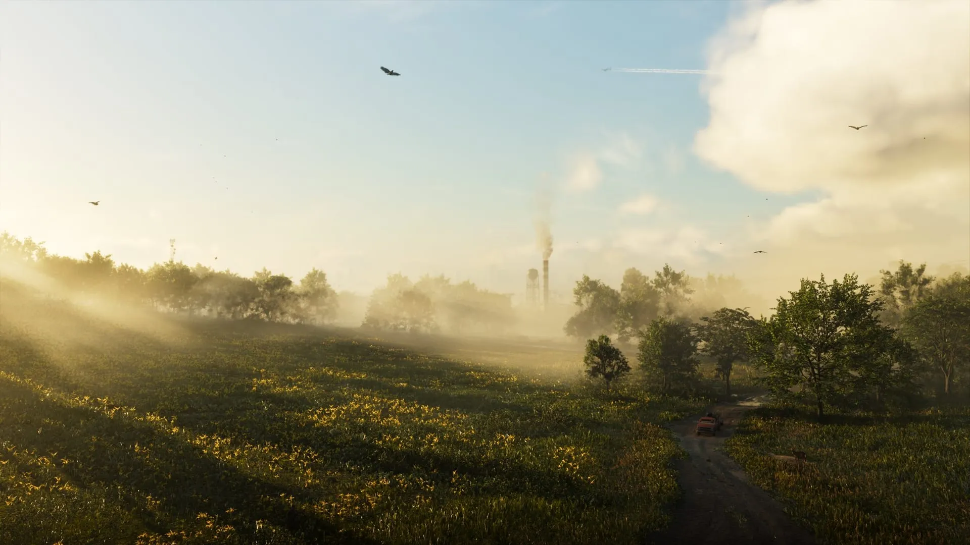
Gambit Bay: high humidity lays a low mist over the water and fields, “a tranquil start to hunting season”. It’s the only forecast that mentions hunting, one of the activities confirmed in September. © Rockstar Games, via The Weather Channel.
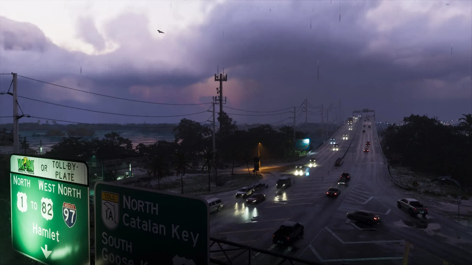
Key Lento: rain and wind make the morning commute “spicy”. The road signs are worth as much as the forecast: they point to Hamlet, Catalan Key and Goose Key, and to a “Vice Pass” toll that can also be paid by plate. © Rockstar Games, via The Weather Channel.
The new names on the signs
The last screenshot adds a bit of geography. The left sign reads Hamlet, reached from route 1 toward route 82 and Interstate 97; on the right, toll road 1A, with a dolphin shield, leads north to Catalan Key and south to Goose Key. Goose Key and Key Lento had already appeared on the map poster photographed at Selfridges; Catalan Key and Hamlet had not appeared in any earlier official material.
“Vice Pass” is a parody of SunPass, Florida’s prepaid electronic toll, alongside the “toll-by-plate” option (the toll charged by reading the plate), which Florida really has.
To find your way around the confirmed areas, there’s our guide to the geography of Leonida.
Summary
- On November 16 The Weather Channel posted six official GTA 6 screenshots on X, each with a weather forecast for Leonida.
- Rockstar’s Owen Shepherd says the weather was rebuilt from scratch to be localized, persistent and dynamic.
- The images show rain in the Keys, a storm over Pelican Valley, sea fog over South Ocean Beach, a tropical storm at the Rusty Anchor, mist over Gambit Bay and rain in Key Lento.
- A road sign shows two names never seen in official material: Catalan Key and Hamlet.
Frequently asked questions
What are the new GTA 6 screenshots?
Six official weather images, posted on November 16, 2026 by The Weather Channel on X with a preview provided by Rockstar. They show the Keys, Pelican Valley, South Ocean Beach, the Rusty Anchor, Gambit Bay and Key Lento in rain, fog and storms.
Is GTA 6 weather dynamic?
Yes. Rockstar’s Owen Shepherd describes it as localized, persistent and above all dynamic: it can rain in one area while the sun shines in another. In September Rockstar had already confirmed tropical storms and hurricanes.
Are there hurricanes in GTA 6?
Rockstar confirmed them in September, through Game Informer. The new screenshots show a tropical storm at the Rusty Anchor, but not a hurricane. Whether hurricanes damage the city or change missions hasn’t been said.